
FireSense keeps the incident commander oriented while a firefighter searches a building they cannot see. Thermal cameras and radar ride with the firefighter. The command station outside turns that into a live position, a map that stays straight, and the shape of the rooms around them.
On the firefighter
Thermal cameras show heat through the smoke. This demonstration uses two of them. Radar measures the walls, floors, and openings nearby. The payload follows the firefighter as they move through rooms, halls, and stairs. A smaller payload can use one thermal camera together with radar.
Out to the command station
A compact stream crosses the radio link to the station outside the building. The chief does not have to stand in the smoke to watch the search.
On the chief’s screen
A live position, the path already walked, the heat in view, and a structural picture of the space. It keeps updating for the whole entry.
Loop closure
Small motion errors add up. Over a long search the building on the screen would slowly bend, and a hallway walked twice would no longer meet itself.
When the firefighter returns to a place they have already been, the system recognizes it and pulls the path and the map back into agreement. A room visited twice stays the same room, and the route between those visits holds for the rest of the entry.
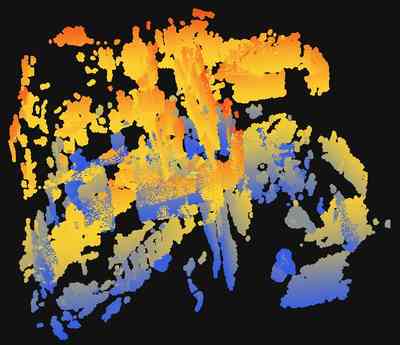
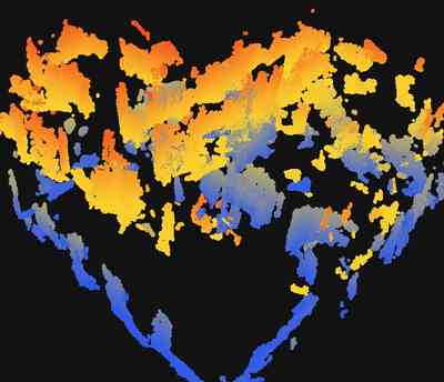
These pictures are from a search with two thermal cameras. A smaller payload can do this job with one thermal camera and radar.
Radar mapping
Heat shows what is hot. It does not, by itself, draw the floor plan. Close to a hot surface, or in a view with little shape, the thermal image cannot outline the room.
Radar supplies that structure. The command station turns it into the surfaces the firefighter is moving through, so the chief sees walls and openings, and where the firefighter stands among them, rather than only a trail.
In another setup, radar does both: it draws the building and it recognizes a return. The thermal camera remains for the heat.
How a search runs
Stand still. The map starts level before anyone moves.
Search. Position, path, heat, and the shape of the space update together.
Finish. The map can be saved and looked at again after the entry.
This demonstration is one handheld payload and one command station. A second firefighter, and one shared map of both, remains the longer-term system.