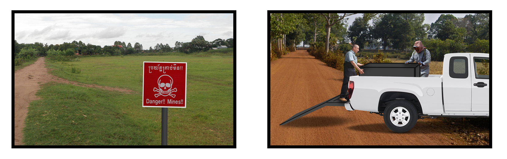
Andrew is a local resident of Krong Battambang province in Cambodia. He is employed as a land surveyor by the local branch of Cambodia Mine Action Centre (CMAC), a Government Organization responsible for the survey, clearance and release of land which is suspected to be contaminated with landmines from the Khmer Rouge conflict. Today he and his team will be surveying a patch of fertile land, as in Figure ###, a task which involves scanning the ground for landmines, unearthing them and safely disposing of them, with the intent of allowing farmers to confidently use the land once more. CMAC has recently acquired a Clearfield Robotics Surveying Cart. Andrew and his colleague Brian lift the cart from off the back of their work truck and wheel it over to the edge of the field.
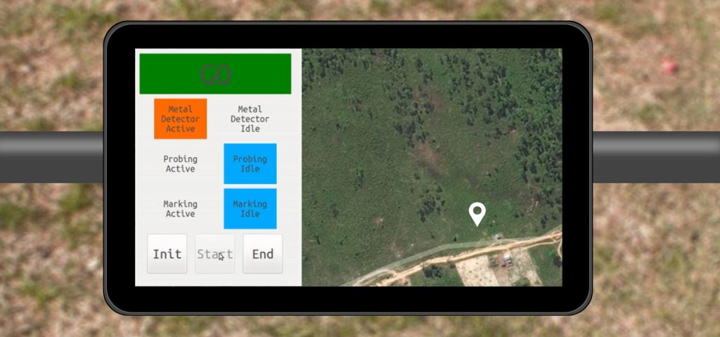
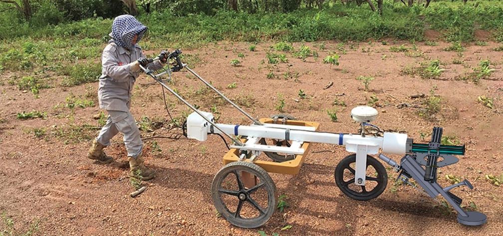
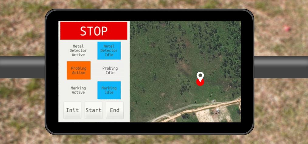
Andrew switches on the system and the handlebar-mounted user interface (UI) displays his present location overlaid on a satellite image, along with the current system status and state. With a few finger taps, he initializes the system and beings the sweeping sequence. The UI directs him to proceed pushing the cart through the field.
As Andrew pushes the machine along his first row, he notices that on his map display the land which he has covered is marked green. Suddenly, his attention is drawn by a warning on the tablet. The system brakes engage and Andrew comes to a halt. The system pinpoints the target with the metal detector, and then investigates it with the probing unit. No landmine is detected, so all warnings clear and Andrew is directed to continue searching. He reaches the end of the lane and swings the machine around to intercept the new path. Shortly after, the warnings appear again, but this time the sensor signature confirms that a landmine has been found. The machine marks the landmine location with spray paint and marks the threat with a red dot on the map. Andrew reorients the cart and continues the survey, careful to avoid the marked location of the landmine.
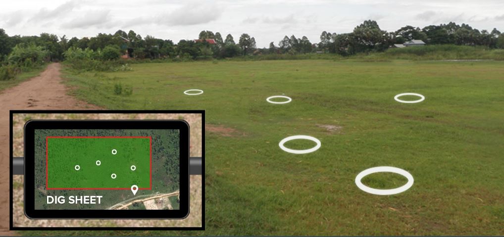
Once Andrew has investigated the entirety of the field, he presses the “End” button on the UI and is presented with a dig sheet that shows him the location of all the landmines in the searched area. Andrew and his clearance team use the dig sheet to unearth the landmines and transport them elsewhere for destruction. By the end of the day, Andrew has surveyed the entire field and a record of his day has been transmitted to the local CMAC office. This record consists of a satellite image overlaid with his path and the number of landmines found.